It can be easy to take for granted the data we have at our disposal about where we live. Everything from traffic to cafes is layered onto our maps, enabling us to run our errands, avoid accidents, and get exactly the right region of Thai food we want for lunch.
The truth is, the ancient Romans probably took all that for granted too, because goofy togas or not, they had knowledge, they had tech, and they wrote it all down. And because of that, we know tons about just exactly how they liked to lay out a new city.
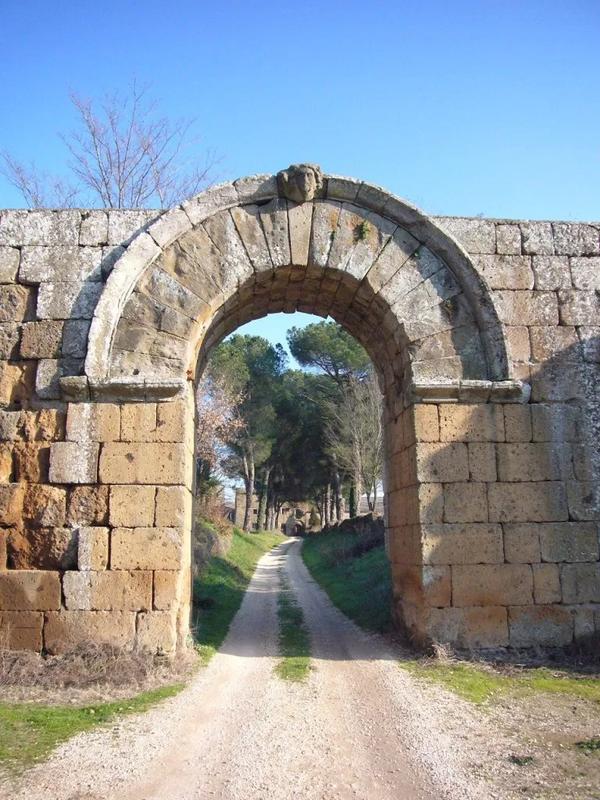
But you take some barbarians here, some basic decline and weathering there, some stuff falls out of order, and before you know it, you're having a hard time finding your way to your favorite breakfast spot in the ancient Roman city of Falerii Novi.
Enter a team of archaeologists from the University of Cambridge in England and Ghent University in Belgium. Using the latest in ground penetrating radar (or GPR), which dates back to 1910 and has already been applied to problems ranging from glacier depth to forgotten land mines, the scientists would be able to glean information not readily apparent either during the first physical excavation of the city some thirty years ago, or during less sophisticated non-invasive techniques in the intervening years.

Thus, while a reconstructed map of the city already featured various notable structures, including shops, marketplaces, warehouses and more, a new scan of the roughly 75 acres where the city stood via an ATV-mounted GPR device added previously unreachable detail to our understanding of the city and its evolution over centuries of inhabitation by orders of magnitude.
The results of the new survey (and one conducted with similar methods in 2017) include a variety of new buildings and structures beneath what had already been excavated- an outcome that would once have been impossible without damage to the construction from the later years of the city in shallower depths. The results were especially good due to the ideal conditions of the Falerii Novi site, which had the sandy soil, dry climate, and absence of modern construction in which GPR functions best.
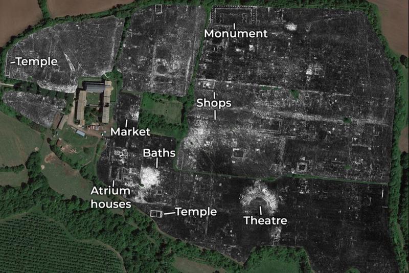
The newly found structures include a temple that would have been the size of St. Paul's cathedral, public monuments near the city's north gate, and the remains of an open-air pool that had been part of an extensive public baths system that would have been typical of any Roman city in which significant investment had been made.
The survey was so successful that the biggest problem of the team of archaeologists will be fully analyzing their now extensive data set, which encompasses some 71.7 million readings, and drawing conclusions. What is known from it so far is merely the most low-hanging fruit of a cursory examination, and it will take nearly fifty hours to fully scrutinize the data points from each acre.

The success of the new technique, signal major breakthroughs to be made at a number of ancient sites in Turkey, Greece and more. "The astonishing level of detail which we have achieved at Falerii Novi, and the surprising features that GPR has revealed, suggest that this type of survey could transform the way archaeologists investigate urban sites, as total entities," said co-author Martin Millett of the University of Cambridge