These days, with a lot of down time and not a lot of opportunities to spend it away from home, many are looking to self-improvement, committing to diets, exercise, jigsaw puzzles and new languages as ways to become better people in quarantine- not to put any undue pressure on you!
But of course, the need for action is only all the greater outside of ourselves, and so the opportunities to spend the time serving others are endless- even overwhelming- even if one confines oneself to the earth. There are demonstrations, there are charities, and there is a great deal more.
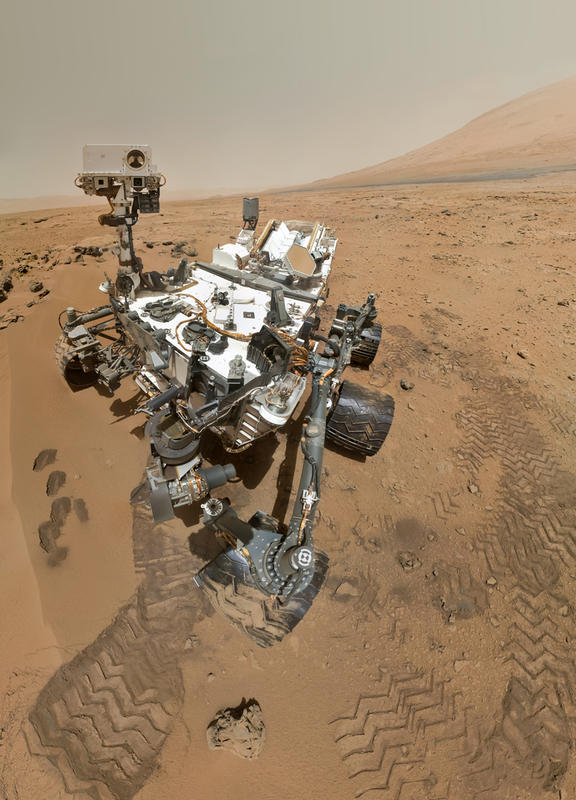
Some people felt moved to look beyond the earth, and found an unassuming little buggy tooling around a stark red landscape up on mars who needed their help. They didn't mind giving it directions from their cramped computer desk down on Earth, and surely the Curiosity rover would reciprocate!
NASA has scientific targets on Mars, but they have lacked sufficient data to plot courses for the Curiosity rover to safely and efficiently travel there. Durable and adaptable to terrain though the six wheeled rover is, it remains vulnerable. Previous rovers such as Spirit and Opportunity, which landed in 2004, were taken out by soft soil and a dust storm before their natural lifespans were able to play out.

In order to avoid a similar fate while traversing the planet's rugged terrain, which would deal a serious blow to efforts to chart and explore the planet (given that rover dealerships on Mars are sparsely located to say the least, it is critical that the rover's Earth-bound support team is able to feed it accurate data in order to keep it functional as long as possible.
In order to evade spots where the rover might get stuck, a machine learning project has been designed to acquire data identifying them automatically, but manually defined labels were needed to be fed into it in order to advance the process. This is the AL4MARS program, and it is where the public's participation came in.

With just the manpower of NASA's rover team alone, it takes hours to identify a destination and plot a course easy on the rover's locomotive equipment to get there. That process could be sped up considerably with an effective algorithm, but that would require thousands of images of Mars' surface that do not exist. But a crowd-sourced effort to add data to them by means of labeling helped make that algorithm a possibility, extending the rover's lifespan and supercharging the exploration effort.
With the help of over 2,600 volunteers, 122,891 classifications were added to the team's maps and all 21,199 subjects were completed. With that done, it will be possible to not just learn the lay of the land better in order to avoid obvious hazards, but to learn better how the rover will react to different surfaces before it reaches them. And thus, with a better driver at the wheel, the rover will be able to sooner deliver to us evidence of once-habitable areas of Mars.

If you're just learning of this now and are eager to help a rickety little vehicle get around obstacles better, you probably need look no further than the Roomba that can't get up your stairs! It's an Earth rover with the mission of learning whether your apartment was ever habitable.