
Piri Reis was an admiral in the navy of Turkey, and as such he was an experienced sea traveler. Wherever he went, he took his own hand-drawn personal map with him. So far, you're probably wondering what the big deal is. The answer lies with the map's content.
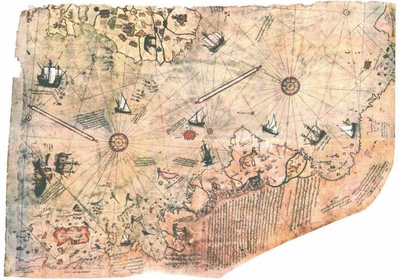
On Reis' map, we can see Europe, Brazil, and North Africa. There are a number of islands dotted around the sea, too. The head-scratcher is the inclusion of the coast of Antarctica. The map was drawn in 1513, and Antarctica wasn't officially discovered until the 1800s.